This is a long one:
Before I left the US, my mom asked me about my travel methodology. This trip, on the whole, won't serve as a great example since most of the planning was done by my good friends Stephanie and Joanna. On the other hand, the last three days are a great example of how I travel. To arrange this part of the trip I merely followed the following steps
Step 1: WHERE? The answer to this question can be determined in as arbitrary a method as you like. For example, I chose Folkestone because it had some of the cheapest hotel prices within a 2 hour train trip of London. Arbitrary.
Step 2: BOOK A ROOF. This is the most important step. I've learned the dangers of traveling without reservations. It often means sleeping outside, sometimes in less than savory spots. My earliest memory of this is Copenhagen, summer of '92. My family spent $100 for a train-car style staff room in the basement of a hotel.
Step 3: GET THERE. There is a bit of work involved in this. In addition to researching transportation I also print a copy of the Hotel address and a google map of the area before I travel. The map is so I don't get lost, the address is so I can get a cab if I do get lost.
Step 4: GO. Yup. I generally do very little additional planning until I am in the location. Sometimes I'll do some research on what locals like about their town or city, but generally I like to be surprised.
 These steps sum up how I came to spend three days in Folkestone, Kent and what I did with my time. Folkestone is a small town on the southeastern coast of England. Apparently it is one of England's holiday destinations as the town is packed with holiday-goers and tourists (mostly British, French, and German - I think I might be the only American here). Of course, since I was following my methodology, I didn't know discover it was a holiday destination until well after I arrived.
My flight landed at Heathrow Airport early (think 5 am early) Saturday morning and, with the help of several exceptionaly courteous Heathrow employees, I checked the luggage I'm not hauling around England at the left-baggage office and found my way to St. Pancras Station in London via tube. From there I purchase a 36 pound ticket on the high-speed line to Folkeston Central station. The trains left St. Pancras every hour, so I got some coffee and enjoyed the view until it was time to go (I do that quite a lot).
I arrived in Folkestone around 10 am and almost immediately discovered a small flaw in my arrangements: even though I booked a roof, I neglected to make arrangements for my luggage for the several hours before the Four PM check-in time. For the next several hours I wandered around town with my backpack on my back. During that time, I found my way into the shop-lined center, to the Leas, the Harbor, and the fish market, and eventually to a shady spot on the grass where I took a jet-lag induced nap. It was during my initial acquaintance with Folkestone that I stumbled upon the activities that have filled my time for the last couple of days:
1. Sunday: Walks to the Countryside. On The Leas Promenade near the Leas Cliff Hall there is a map showing walking paths to various places in town and in the countryside surrounding Folkestone. They say things like "Follow the Rabbit to the Warren," or "Follow the crab to the Lower Leas Park." On Sunday, I tried "follow the Kestrel to the Folkestone Downs." I shouldn't say "tried." Early in the morning I found and followed the Kestral through many streets and shortcuts along dark, narrow paths where the branches of the trees that lined either side reached up to each other. Eventually I cam to a hill and climbed it. At the top I was rewarded with a large patch of purple-flowered thistles and spectacular view of town, but being some distance from the ocean, I knew I was not where I wanted to be.
Later in the day, I approached The Downs from the opposite direction. I followed the Rabbit along the hills right by the water until I came to a path leading upwards toward the white cliffs. I later discovered (from a sign post) that the path I was on is called the "North Downs Way" and it loops runs from Folkestone, to Dover, to Canterbury (for more about the trail and a map, click here.) It took me half an hour to climb the path in the steamy summertime air, but from the top I could see far out into the deep blue channel, and on the horizon, a sliver of land: France. I followed the trail along the cliffs until I came to several mounds of grass covered earth surrounding a statue of an airman gazing accross the chanel toward France - a memorial to the Battle of Brittain.
 I never intended to visit this particular memorial. I knew it was in Folkestone, but I always just assumed I wouldn't have the time or the inclination to do the kind of research that would get me there. And here I was on an adventure that involved the memorial. The memorial itself is simple, the statue situated in the center of paths designed like propeller blades, amidst bunker-like hills. Two replica fighter planes (including a spitfire) and a black marble wall with the names of the airmen who lost their lives are the only other components of the memorial, nevertheless, it is a moving experience to stand with the stone airman and look across so narrow a boundary line toward France.

 2. Canterbury: After my long day walking here and there Sunday, this morning I wanted to do just a bit less on foot. Over the course of my various wanderings through town on Saturday and Sunday, I often saw a bus that read: 17 - Canterbury. Now, when I came to Folkestone, I knew I was in the same neighborhood as Canterbury, but it never occurred to me that I could get a public bus there from Folkestone. Since that was now a distinct possibility, a bus ride to Canterbury (and in particular, it's amazing cathedral) seemed like a great way to spend today. But first I had to take care of some business. When I went to charge my camera battery early this morning, I discovered that a charger was not among the various camera accessories in my case. I'm not sure how it found its way out, but I needed to find a solution to the charger problem before I did anything else. A bit of Google research brought me to the happy hope that I could obtain some kind of universal charger at a store called Maplins (the interweb said it was a bit like Radio Shack in the U.S.). As a happy stroke of luck would have it, there is a Maplins in
Folkestone, not far, it would seem, from that Thistle and Bramble crowned hill I climbed Yesterday morning. So this morning, I set off once again on the trail of the Kestrel, but this time with a different object in mind. I arrived at Maplins exactly 7 minutes after they opened and found not one but three universal Lithium Ion chargers. I hate making choices. Fifteen minutes later I decided on the one that 1. Looked coolest and 2. had the lowest price. and began walking back into town where I deposited my charger in my lodgings and being starved after several low protein days, went to a little place called Cafe Luca for Scrambled eggs on toast before beginning my personal pilgrimmage to Canterbury.


Rambling and poking and wandering around Folkestone meant that I knew exactly where the bus terminal was (not that it takes much findin as it is right next to the heart of town), so after breakfast I went to see if I could figure out how to get to Caterbury. There wasn't much to figure out. The bus attendant took one look at me, asked in a friendly manner if he could help me. Set me on the correct platform armed with three bus numbers and knowledge of the fare and timetable. It seems that a bus goes to Canterbury from Folkestone every 16 minutes or so.
 Canterbury's center is quite a lot larger than Folkestone's. This makes sense given that town's historical importance nevertheless, it felt congested and crowded. Like Folkestone, the Canterbury Bus terminal is right next to the heart of town. Pedestrian-only streets lined with Tudor style shops and cafes are easily navigated with landmark signs that point the way to major attractions. Somehow the whole think felt like a historical Disney Land, only with a really cool ancient church. I easily found my way to the Cathedral and spent nearly two hours sitting, meditating, and enjoying the beauty of such a magnificent set of creations that join together so harmoniously (like many building from the middle ages, some parts of the Cathedral were built more than a century apart).
Part I of my trip is complete and tomorrow I head back up to London. Yet to come: Part II - London, Part III Lake district walk, Part IV Scotland.
Before I left the US, my mom asked me about my travel methodology. This trip, on the whole, won't serve as a great example since most of the planning was done by my good friends Stephanie and Joanna. On the other hand, the last three days are a great example of how I travel. To arrange this part of the trip I merely followed the following steps
 |
| The Folkestone Train bridge |
Step 2: BOOK A ROOF. This is the most important step. I've learned the dangers of traveling without reservations. It often means sleeping outside, sometimes in less than savory spots. My earliest memory of this is Copenhagen, summer of '92. My family spent $100 for a train-car style staff room in the basement of a hotel.
Step 3: GET THERE. There is a bit of work involved in this. In addition to researching transportation I also print a copy of the Hotel address and a google map of the area before I travel. The map is so I don't get lost, the address is so I can get a cab if I do get lost.
Step 4: GO. Yup. I generally do very little additional planning until I am in the location. Sometimes I'll do some research on what locals like about their town or city, but generally I like to be surprised.
 |
| Folkestone's sole sandy beach. Most of the beaches along this coast are pebble |
 These steps sum up how I came to spend three days in Folkestone, Kent and what I did with my time. Folkestone is a small town on the southeastern coast of England. Apparently it is one of England's holiday destinations as the town is packed with holiday-goers and tourists (mostly British, French, and German - I think I might be the only American here). Of course, since I was following my methodology, I didn't know discover it was a holiday destination until well after I arrived.
My flight landed at Heathrow Airport early (think 5 am early) Saturday morning and, with the help of several exceptionaly courteous Heathrow employees, I checked the luggage I'm not hauling around England at the left-baggage office and found my way to St. Pancras Station in London via tube. From there I purchase a 36 pound ticket on the high-speed line to Folkeston Central station. The trains left St. Pancras every hour, so I got some coffee and enjoyed the view until it was time to go (I do that quite a lot).
I arrived in Folkestone around 10 am and almost immediately discovered a small flaw in my arrangements: even though I booked a roof, I neglected to make arrangements for my luggage for the several hours before the Four PM check-in time. For the next several hours I wandered around town with my backpack on my back. During that time, I found my way into the shop-lined center, to the Leas, the Harbor, and the fish market, and eventually to a shady spot on the grass where I took a jet-lag induced nap. It was during my initial acquaintance with Folkestone that I stumbled upon the activities that have filled my time for the last couple of days:
 | |
| One of many Folkstone staircases leading from town to the Lower Leas and beach below. |
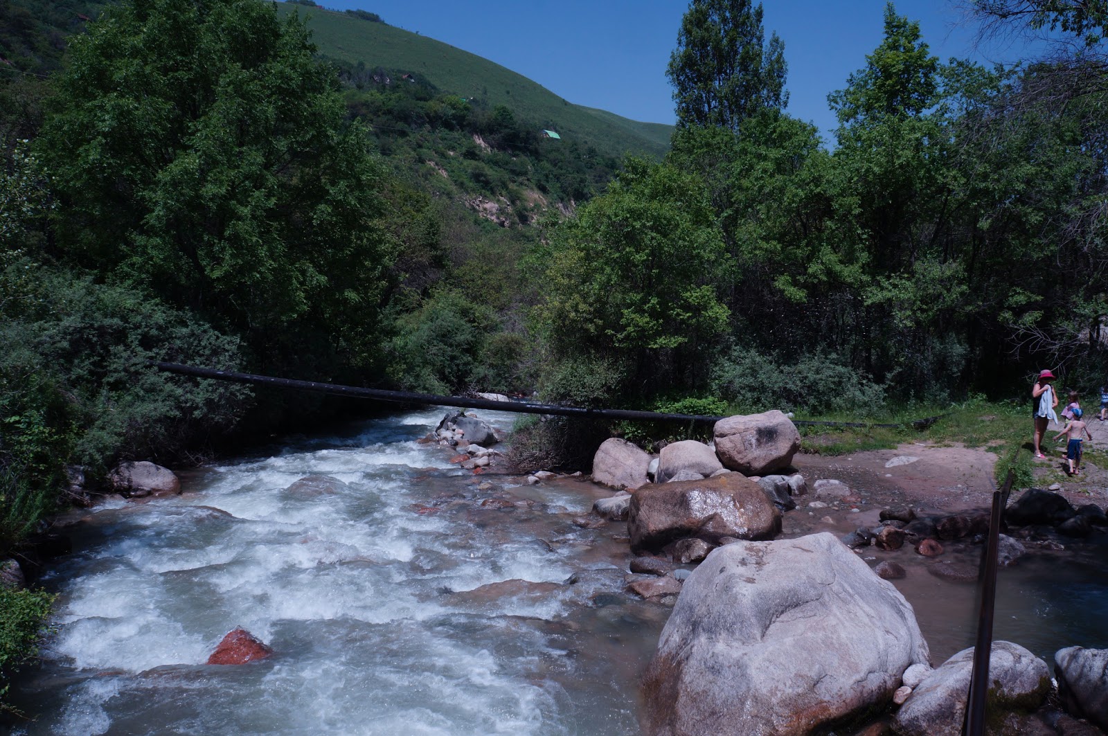
 |
| The view from atop the thistle-crowned hill |
Later in the day, I approached The Downs from the opposite direction. I followed the Rabbit along the hills right by the water until I came to a path leading upwards toward the white cliffs. I later discovered (from a sign post) that the path I was on is called the "North Downs Way" and it loops runs from Folkestone, to Dover, to Canterbury (for more about the trail and a map, click here.) It took me half an hour to climb the path in the steamy summertime air, but from the top I could see far out into the deep blue channel, and on the horizon, a sliver of land: France. I followed the trail along the cliffs until I came to several mounds of grass covered earth surrounding a statue of an airman gazing accross the chanel toward France - a memorial to the Battle of Brittain.
 |
| The white Cliffs of the Downs |


 2. Canterbury: After my long day walking here and there Sunday, this morning I wanted to do just a bit less on foot. Over the course of my various wanderings through town on Saturday and Sunday, I often saw a bus that read: 17 - Canterbury. Now, when I came to Folkestone, I knew I was in the same neighborhood as Canterbury, but it never occurred to me that I could get a public bus there from Folkestone. Since that was now a distinct possibility, a bus ride to Canterbury (and in particular, it's amazing cathedral) seemed like a great way to spend today. But first I had to take care of some business. When I went to charge my camera battery early this morning, I discovered that a charger was not among the various camera accessories in my case. I'm not sure how it found its way out, but I needed to find a solution to the charger problem before I did anything else. A bit of Google research brought me to the happy hope that I could obtain some kind of universal charger at a store called Maplins (the interweb said it was a bit like Radio Shack in the U.S.). As a happy stroke of luck would have it, there is a Maplins in
 Folkestone, not far, it would seem, from that Thistle and Bramble crowned hill I climbed Yesterday morning. So this morning, I set off once again on the trail of the Kestrel, but this time with a different object in mind. I arrived at Maplins exactly 7 minutes after they opened and found not one but three universal Lithium Ion chargers. I hate making choices. Fifteen minutes later I decided on the one that 1. Looked coolest and 2. had the lowest price. and began walking back into town where I deposited my charger in my lodgings and being starved after several low protein days, went to a little place called Cafe Luca for Scrambled eggs on toast before beginning my personal pilgrimmage to Canterbury.


Rambling and poking and wandering around Folkestone meant that I knew exactly where the bus terminal was (not that it takes much findin as it is right next to the heart of town), so after breakfast I went to see if I could figure out how to get to Caterbury. There wasn't much to figure out. The bus attendant took one look at me, asked in a friendly manner if he could help me. Set me on the correct platform armed with three bus numbers and knowledge of the fare and timetable. It seems that a bus goes to Canterbury from Folkestone every 16 minutes or so.
 Canterbury's center is quite a lot larger than Folkestone's. This makes sense given that town's historical importance nevertheless, it felt congested and crowded. Like Folkestone, the Canterbury Bus terminal is right next to the heart of town. Pedestrian-only streets lined with Tudor style shops and cafes are easily navigated with landmark signs that point the way to major attractions. Somehow the whole think felt like a historical Disney Land, only with a really cool ancient church. I easily found my way to the Cathedral and spent nearly two hours sitting, meditating, and enjoying the beauty of such a magnificent set of creations that join together so harmoniously (like many building from the middle ages, some parts of the Cathedral were built more than a century apart).
 Part I of my trip is complete and tomorrow I head back up to London. Yet to come: Part II - London, Part III Lake district walk, Part IV Scotland.