
 |
| Ambleside |
Morning at the Robinson Place Farm B&B in Langdale
brought a full English breakfast with eggs, bacon, sausage, mushrooms,
tomatoes, and toast along with periodic showers interspersed with bright
moments of sunshine. We had
arranged to take a day off of hiking for our second day and so after a leisurely morning taking
advantage of the internet connection at Robinson Place Farm, we set out for a slow stroll to Grasmere - a charming town about four miles from Langdale.
We strolled along the country lanes following the directions
Google provided to us until we arrived at a town that was not Grasmere. We'd walked all the way to Ambleside - nearly six miles from Langdale. As it turns out Ambleside has buses that run out to Dungeon Ghyll, so
even though we walked a lot farther getting there, we didn’t have to walk back. We lunched, strolled, sourvenir
shopped, ate ice cream, and took photos of the old English buildings of
Ambleside before catching the bus back to Dungeon Ghyll.
When we woke up for our day of hiking from Langdale to
Wasdale head, threatening dark clouds blanketed the valley
we were to hike up. A park ranger
stationed at our trailhead behind the Old Dungeon Ghyll Hotel told us to
expect rain from 10 to 12 and from 4:00 on. We’d already decided to take the low route today and not go
up Scafell pike, but the ominous forecast reinforced our choice. As a precaution against sudden showers,
I wore my raincoat, and pulled an orange rain cover over my day pack.
 |
| the view back toward Langdale |
We walked up the valley along the Langdale portion of the Cumbria
way trail with the threat of rain always ahead. Along the way we met a German gentleman who was taking his
teenage kids up Scafell pike.
“I walked this exact same trail twenty years ago,” he
informed us.
"can you see us here in twenty years?!" my friend Joanna asked us.
"can you see us here in twenty years?!" my friend Joanna asked us.
 |
| Angle Tarn |
After a couple of miles of loose stone trail on the valley
floor the path crossed a small stream, and began climbing. This portion of the trail is a recently restored packhorse
trail. This means stairs lots and lots of stone stairs that lead
to the saddle between Rossett Pike and Hanging Knotts. We climbed and climbed, and even though the sky retained it's ominous grey hue, the rain didn’t fall. We paused for lunch on the
banks of the black waters of Angle Tarn before
climbing more stone stairs to a cross-wall shelter (a stone wall built in the shape of a cross to provide shelter from the wind for travelers along the path) and the highest point of
our low route hike. From the
shelter, we could see across the valley, across Langdale Pike all the way to
Ambleside.
 |
| Ambleside is at the end of the large lake you can see in the distance |
At this cross wall shelter, the high path to the top of Scafell Pike
breaks from the lower route down to Sty Head Pass. We chose the lower route and followed the little gully that
held Ruddy Beck downhill to Sprinkling tarn, and then to Styhead Tarn and
Styhead pass. From the pass we
could see into the next valley down to the little collection of white buildings
that make up Wasdale head. And as
we reached the bottom of the steep loose-stone path leading off Styhead pass,
the heavens final opened and the rain came.
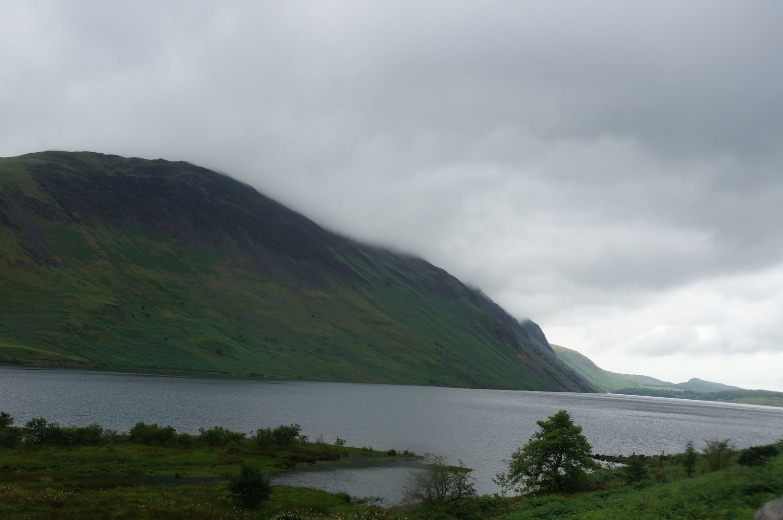 |
| Wast Water in the rain |
Wasdale Head is a little community near the shores of the
lake called Wast Water. It is famous for
it’s proximity to the great mountains of Scafell pike and Great Gable and for
St. Olaf’s church (the smallest church in England with a cementary that is home
to those who lose their lives climbing the surrounding mountains). The town consists of a Hotel, a bed and
breakfast, a sporting goods and general supplies shop, a pub, and nothing else
unless you count sheep. It only took
us a couple of seconds to find our way to the Bed and Breakfast housed in an
old vicarage where we were to spend the night.
 |
| Mud and Clouds at Styhead Tarn |
 |
| Stairway in the clouds |
The rain fell through the night and we knew we were in for a
wet walk. Since our guide strongly
cautions against attempting to climb Great Gable (the high route) in bad
weather, the low route was the way we were going. In the overnight rain the
tiny springs that had trickled down between the stones in the path had grown to
full-fledged brooks and streams that not only rushed across the path, but often
used the path as their riverbeds.
As we climbed into the clouds that obscured the mountains, I was
increasingly grateful for a good rain coat and a good pair of boots. With the reduced visibility and the
added challenge of crossing the many streams and torrents on the path it took
us a bit over two hours to reach the top of Styhead pass. As we headed north along the edge of Styhead Tarn and along the now raging
Styhead Gill (a gill is a
river). Our trail wound
down the hillside, sometimes disappearing entirely under the current of the
bucking white water forcing us to pick our way across the
stony, and sometimes boggy, grassy hillside.
 |
| Crossing Stockley Bridge |
There is only so much a pair of boots can do to hold out the
weather though, and all of the wading through torrents of water rushing down
the mountainside began to take its toll as water worked its way into my boots
and condensation built up on the inside of my rain jacket. As we descended into the valley, I was
beginning to feel a bit water logged. When we reached the valley and crossed
the old stone Stockley Bridge we still a long way to go. We walked for more than an hour through
endless stone-walled pastures passing through at least a dozen gates. Water, now in the form of deep puddles
still obscured the path and often the only way through a gate was to wade
through a deep stretch of water. We crossed the road and “Folly Bridge” and
made our way in along a wooded path next to the River Derwent until we came to a place
where the path was blocked by a large rocky protrusion that reached out into
the rapids of the brown water. We picked our paths through the rocks, trying not to look at
the raging river crossing a slab of rock with the help of a chain attached just
above a natural crack across the slab.
Past the youth hostel and across another field, it was less
than a mile to the Royal Oak Hotel.
The Royal Oak Hotel – the perfect ending for a marvelously wet day
walking along the fells and among the peaks of the Lakes. The Royal Oak Hotel
and their warm inquiry as we walked in “tea and scones?” Yes please!
No comments:
Post a Comment